Johns Creek North runs from Abbotts Bridge Road to the Forsyth County line, mostly in ZIP 30005, and is zoned mainly for Chattahoochee High.
Last checked Oct. 5, 2026. Sources: the City of Johns Creek comprehensive plan and its Community Areas map layer, Fulton County Schools address map data, the state’s 2025 School Grades data, Zillow Research, the City of Alpharetta, MARTA and OpenStreetMap.
Johns Creek North is the city’s northwest corner: the subdivisions along Jones Bridge, Kimball Bridge and Sargent Roads between Abbotts Bridge Road and the Forsyth County line. It is one of the eight Community Areas in the city’s comprehensive plan, and the plan describes it as a continuation of the growth that followed the Georgia 400 expansion and the Windward development next door in Alpharetta in the 1980s and 1990s.
What this means for you
- Zoned high school: Chattahoochee High for 76% of addresses, Northview High for 24%. Check yours with the district’s Find Your School lookup.
- Home value: $753,318 in ZIP 30005 in August 2026, according to the Zillow Home Value Index.
- Nearest Georgia 400 exit: exit 10, Old Milton Parkway, about 4.4 miles by road.
Part of our Johns Creek neighborhoods guide.
Where it is
The comprehensive plan’s Johns Creek North chapter describes the area as bounded on the east by Johns Creek, the stream that runs north to south through the whole city, and the Tech Park Community Area; on the south by Abbotts Bridge Road; on the west by the City of Alpharetta; and on the north by Forsyth County. The city’s map layer puts it at about 1,889 acres.
The plan names Seven Oaks, Cambridge and Wellington as the largest subdivisions and counts 13,445 residents in 2022. It describes most of the subdivisions as late 20th century, with curving streets and landscaped entrances.
Of the area’s 4,551 address points in the school district’s map data, 88% are in ZIP code 30005 and 12% in 30097. Mailing addresses in those ZIPs often read “Alpharetta” or “Duluth,” but the area is inside Johns Creek city limits, so the city provides police, fire and road services.
Schools
Of the 4,551 address points in this area in the Fulton County Schools map data on Oct. 5, this is how the middle and high school zones split. Scores are 2025 College and Career Ready Performance Index (CCRPI) figures from the state’s School Grades report; the state average was 76.9 for high schools.
| Level | School | Share of addresses | 2025 CCRPI |
|---|---|---|---|
| High | Chattahoochee High (report card) | 76% | 96.8 |
| High | Northview High (report card) | 24% | 98.5 |
| Middle | Taylor Road Middle (report card) | 76% | 97.2 |
| Middle | River Trail Middle (report card) | 24% | 96.3 |
| Elementary | Findley Oaks Elementary (report card) | Split | 97.4 |
| Elementary | Abbotts Hill Elementary (report card) | Split | 95.5 |
| Elementary | Lake Windward Elementary (report card) | Split | 99.2 |
The district’s 2025-26 zone map splits the area among three elementary schools, with Findley Oaks covering about half of the land, so check the exact address. Findley Oaks Elementary, at 5880 Findley Chase Drive, and Abbotts Hill Elementary, at 5575 Abbotts Bridge Road, are inside the area, according to the federal NCES directory. Zone maps for every school: the district’s attendance zones page.
Home values
The typical home value in ZIP 30005 was $753,318 in August 2026, down 1.17% from $762,221 in August 2025, and in ZIP 30097 it was $710,739, down 0.36% from $713,339, according to the Zillow Home Value Index. The index is a modeled typical value for the middle third of homes, not a sale price. Both ZIP codes reach well beyond this area: 30005 also covers part of Alpharetta, and 30097 the east side of Johns Creek and part of Duluth. The citywide Johns Creek figure was $695,041, up 0.59% on the year. Recent sales are in our weekly real estate transfers.
Parks and trails
The plan says Johns Creek North has no community park inside its boundaries. The nearest:
- Webb Bridge Park, 4780 Webb Bridge Road, just across the city line in Alpharetta, which the City of Alpharetta lists as open 8 a.m. to 10 p.m. daily on its parks and facilities pages.
- Ocee Park, 10900 Buice Road, to the south in the Ocee area, with a walking and jogging path and a nature trail, open 6 a.m. to midnight, according to the city’s Ocee Park page.
- The Boardwalk at Town Center, behind City Hall at 11362 Lakefield Drive, to the east in Tech Park: a trail of about a mile around a pond, per the city’s Boardwalk page.
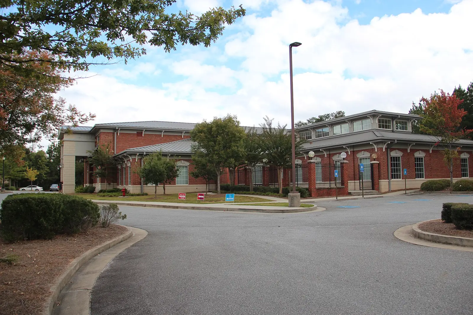
The Dr. Robert E. Fulton Regional Library at Ocee, 5090 Abbotts Bridge Road, is inside the area. The plan calls for sidewalks and trails along Jones Bridge, Kimball Bridge and Abbotts Bridge Roads. More in our walking and biking trails guide.
Getting around
- Georgia 400: exit 10, Old Milton Parkway, is about 4.4 miles by road from the library on Abbotts Bridge Road, and exit 11, Windward Parkway, about 5.4 miles. Exit numbers are from OpenStreetMap.
- City Hall and Town Center: about 3.7 miles by road to Johns Creek City Hall, 11360 Lakefield Drive.
- Airport: about 39 miles by road to Hartsfield-Jackson Atlanta International Airport. Distances are measured from the library on the OpenStreetMap road network with the OSRM routing engine; they are distances, not drive times.
- MARTA: no MARTA bus stops are inside the area, according to MARTA’s schedule data. The nearest are route 140 stops in Alpharetta, about 3 miles west in a straight line.
- Main roads: Jones Bridge Road runs north and south through the area; Abbotts Bridge Road, Kimball Bridge Road and McGinnis Ferry Road, on the county line, run east and west.
Groceries and everyday stores
The plan counts two major shopping centers along Jones Bridge Road and proposes a village center at Jones Bridge and Douglas Roads. From OpenStreetMap:
- CVS Pharmacy, Abbotts Bridge Road, inside the area
- Publix, 11585 Jones Bridge Road, just south across Abbotts Bridge Road in the Ocee area
- Publix, 5180 McGinnis Ferry Road, just north of the city line
How we drew this area
The name and boundary come from the City of Johns Creek’s comprehensive plan, and the outline from the city’s Community Areas map layer; you can check an address with the city’s Which Community Area Do I Live In? lookup. School and ZIP shares come from every address point inside that outline in the Fulton County Schools map service, checked Oct. 5, 2026. Store and library locations are © OpenStreetMap contributors.
Frequently asked questions
Where is Johns Creek North?
The city’s comprehensive plan places it between Abbotts Bridge Road on the south and the Forsyth County line on the north, with Alpharetta to the west and the Johns Creek stream and Tech Park to the east.
What high school is Johns Creek North zoned for?
Chattahoochee High for 76% of the area’s addresses in the Fulton County Schools map data and Northview High for the other 24%. Check an exact address with the district’s Find Your School lookup.
What ZIP code is Johns Creek North?
Mostly 30005, which covers 88% of its address points, with the rest in 30097. Mailing addresses there often read Alpharetta or Duluth, but the area is inside Johns Creek.
What is the typical home value in ZIP code 30005?
Zillow put it at $753,318 in August 2026, down 1.17% from $762,221 a year earlier. The figure is a modeled typical value, not a sale price.
Have your say