The eight Johns Creek Community Areas in the city's plan, with each area's ZIP code, zoned high school and August 2026 Zillow home value.
Last checked Oct. 5, 2026. Sources: the City of Johns Creek comprehensive plan and its Community Areas map layer, Fulton County Schools address map data and 2025-26 zone map, the state’s 2025 School Grades data, Zillow Research, the Census Bureau, MARTA and OpenStreetMap.
Johns Creek has no downtown grid and no official list of neighborhoods with legal boundaries. What it does have is a map: the city’s comprehensive plan divides it into eight Community Areas, each with its own chapter, and the city publishes a lookup that tells you which one an address is in. This guide uses those eight areas, with a page for each.
What this means for you
- Find your area: enter a full street address in the city’s Which Community Area Do I Live In? lookup.
- Find your schools: zones do not follow area or city lines. Use the district’s Find Your School lookup.
- Check the city line: a mailing address that says Alpharetta, Duluth or Suwanee can be inside Johns Creek, and the reverse. The parcel record with the Fulton County Board of Assessors settles it.
How Johns Creek is laid out
The city covers 31.3 square miles, according to the plan’s city profile. The Chattahoochee River forms its southern and eastern edges, with Gwinnett County across the water; McGinnis Ferry Road and Forsyth County are the northern edge; Roswell is to the west and Alpharetta to the northwest. Johns Creek incorporated in December 2006. It had 81,988 residents in the Census Bureau’s 2020-2024 American Community Survey estimates.
Georgia 400 does not cross the city. It runs through Alpharetta and Roswell to the west, and the nearest exits, 7 through 11, are between about 3.4 and 10 miles by road from a park, library or school in each area. Medlock Bridge Road is the main north-south road, which the plan calls the city’s primary north-south arterial. State Bridge, Old Alabama, Abbotts Bridge, Kimball Bridge and McGinnis Ferry Roads run east and west.
The city’s main ZIP codes are 30022, 30097 and 30005, with small parts of 30024 and 30076. Mailing addresses in those ZIPs often carry the names Alpharetta, Duluth, Suwanee or Roswell: the federal NCES school directory, for example, lists Chattahoochee High, inside Johns Creek, at an Alpharetta address and Northview High at a Duluth address.
School zones do not follow city limits. Fulton County Schools zones most of the city to three high schools inside it, Chattahoochee, Johns Creek and Northview, but most of Newtown goes to Centennial High in Roswell, and parts of the city are zoned for elementary schools outside it, such as Lake Windward, Hillside and Northwood, according to the district’s zone map.
The eight areas at a glance
The ZIP code is the one that covers most of each area’s address points in the school district’s map data. Home values are the Zillow Home Value Index for that ZIP in August 2026, a modeled typical value for the middle third of homes, not a sale price. Each ZIP reaches beyond the area it is listed for.
| Area | Main ZIP | Zoned high school (share of addresses) | Typical value, Aug. 2026 | Guide |
|---|---|---|---|---|
| Autrey Mill | 30022 | Johns Creek (99%) | $668,627 | Autrey Mill |
| Johns Creek North | 30005 | Chattahoochee (76%), Northview (24%) | $753,318 | Johns Creek North |
| Medlock | 30097 | Johns Creek (51%), Northview (48%) | $710,739 | Medlock |
| Newtown | 30022 | Centennial (74%), Johns Creek (26%) | $668,627 | Newtown |
| Ocee | 30022 | Chattahoochee (81%), Johns Creek (19%) | $668,627 | Ocee |
| River Estates | 30022 | Johns Creek (100%) | $668,627 | River Estates |
| Shakerag | 30097 | Northview (100%) | $710,739 | Shakerag |
| Tech Park | 30097 | Northview (100%) | $710,739 | Tech Park |
The citywide Zillow figure was $695,041, up 0.59% from August 2025. On the state’s 2025 School Grades report, the College and Career Ready Performance Index scores were 98.5 for Northview High, 96.8 for Chattahoochee High, 94.5 for Johns Creek High and 88.5 for Centennial High; the state average for high schools was 76.9.
The map
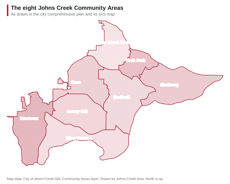
Map drawn by Johns Creek Now from the City of Johns Creek’s Community Areas map layer. Street maps of each area: © OpenStreetMap contributors.
The areas, north to south
Johns Creek North is the northwest corner, from Abbotts Bridge Road to the Forsyth County line along Jones Bridge Road, mostly in ZIP 30005. The plan counts 13,445 residents and no community park inside it; the Fulton County regional library at Ocee is on Abbotts Bridge Road.
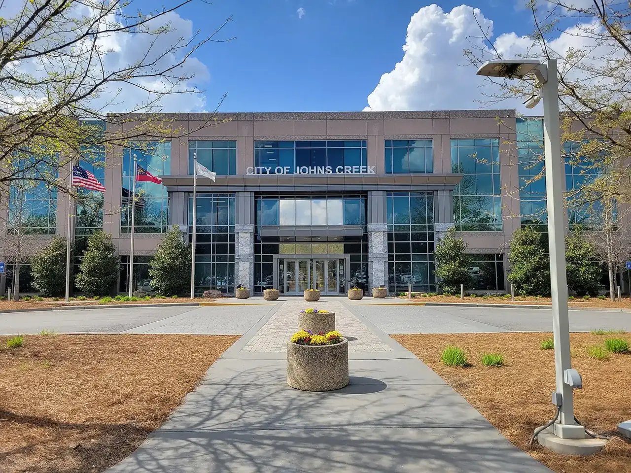
Tech Park is the 1980s office park at Medlock Bridge and McGinnis Ferry Roads that now holds City Hall, the Boardwalk at Town Center park and Emory Johns Creek Hospital. It is the smallest area by population, 2,046 in 2022, and the fastest growing, the plan says.
Shakerag is the northeast corner on the Chattahoochee, with Cauley Creek Park, Shakerag Park and Bell Boles Park, and the most historic properties in the city. Every address is zoned for Northview High.
Ocee is the west side along State Bridge, Jones Bridge and Kimball Bridge Roads, a historic cotton community with three city parks and Chattahoochee High. It had 15,681 residents in 2022.
Medlock is the center, around the Medlock Bridge and State Bridge Road intersection, with Johns Creek High, Northview High and three supermarkets. With 16,298 residents in 2022 it is the most populous area.
Newtown is the southwest corner next to Roswell, built around Newtown Park on Old Alabama Road, with three supermarkets, a pharmacy and no public school inside it.
Autrey Mill is the all-residential middle of the south side, with the Autrey Mill Nature Preserve and Spruill Oaks Library and no stores. Nearly every address is zoned for Johns Creek High.
River Estates fills the river bend at the south end, with the Atlanta Athletic Club and the Country Club of the South. The plan says it has no public park.
Getting around
MARTA’s schedule data shows no bus stops inside any of the eight areas; the nearest are route 140 stops in Alpharetta. Each area guide gives the nearest Georgia 400 exit, the distance to City Hall and the distance to Hartsfield-Jackson Atlanta International Airport, measured on the OpenStreetMap road network. More trails are in our walking and biking trails guide, and the county and neighboring cities are in Johns Creek, Fulton County and the neighbors.
To compare the city with its nearest neighbors on taxes, schools, home values and commutes, see Johns Creek vs. Duluth vs. Alpharetta vs. Peachtree Corners.
How we built this
- The areas are the eight Community Areas in the City of Johns Creek’s comprehensive plan, with the names, boundaries, history and 2022 population figures from each chapter, and the outlines from the city’s Community Areas map layer. We did not invent or merge any areas. OpenStreetMap also marks Newtown, Ocee and Shake Rag as named places.
- ZIP codes and school shares come from every address point inside each outline in the Fulton County Schools map service, and elementary splits from the district’s 2025-26 zone map, checked Oct. 5, 2026.
- School scores are from the state’s 2025 School Grades data; home values from Zillow’s ZIP and city files for August 2026; stores and libraries from OpenStreetMap; distances from the OSRM routing engine on OpenStreetMap roads.
- We do not rank areas or say which suits whom. Every figure is linked so you can check it.
Frequently asked questions
What are the neighborhoods in Johns Creek?
The city’s comprehensive plan divides Johns Creek into eight Community Areas: Autrey Mill, Johns Creek North, Medlock, Newtown, Ocee, River Estates, Shakerag and Tech Park. The city’s online lookup tells you which one an address is in.
What ZIP codes are in Johns Creek?
Mainly 30022, 30097 and 30005, with small parts of 30024 and 30076. Mailing addresses in those ZIPs often read Alpharetta, Duluth, Suwanee or Roswell even inside Johns Creek city limits.
What high schools serve Johns Creek?
Fulton County Schools zones Johns Creek addresses to Johns Creek High, Northview High and Chattahoochee High, all inside the city, and part of Newtown to Centennial High in Roswell. Zones do not follow city limits.
What is the typical home value in Johns Creek?
Zillow’s citywide figure was $695,041 in August 2026, up 0.59% on the year. By ZIP code it was $668,627 in 30022, $710,739 in 30097 and $753,318 in 30005. It is a modeled typical value, not a sale price.
Does MARTA serve Johns Creek?
MARTA’s schedule data shows no bus stops inside any of the city’s eight Community Areas as of October 2026. The nearest are route 140 stops in Alpharetta.
Have your say